Orono Lake Minnetonka Neighborhoods For Home Shoppers
July 23, 2026
July 23, 2026
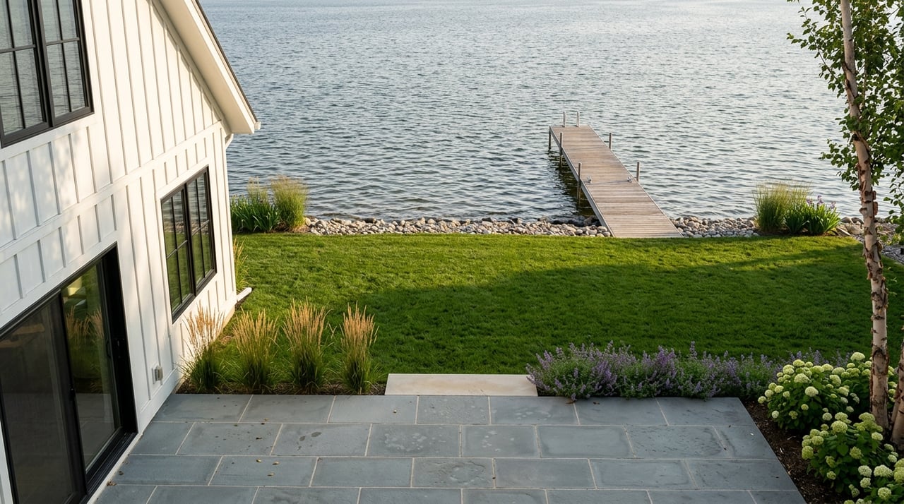
If you are shopping for a home in Orono, it helps to know one thing right away: “Lake Minnetonka in Orono” is not one single neighborhood experience. Orono’s shoreline stretches across beach pockets, wooded bays, larger-lot residential areas, and an evolving village-style corridor, so two homes just a short distance apart can offer very different lifestyles. If you want to compare Orono more confidently, this guide will walk you through the key lake-adjacent areas, what makes each one distinct, and what to verify before you buy. Let’s dive in.
Orono sits along the north shore of Lake Minnetonka, and the city says its identity is strongly shaped by the lake, along with wetlands, streams, and ponds. City planning materials show about 4,750 acres of Lake Minnetonka surface and 40.4 miles of shoreline within Orono.
That scale creates variety. Instead of one uniform waterfront market, you are really looking at a collection of smaller micro-markets with different lot patterns, access types, and neighborhood settings.
Orono also maintains more than 260 acres of parks, trails, and open space. For buyers, that matters because your day-to-day lifestyle may depend not only on direct frontage, but also on nearby trails, beaches, boat launches, fishing platforms, and pedestrian lake access.
Crystal Bay is one of the clearest east-Orono areas to watch if you want an established lake-oriented setting with public amenities nearby. The city identifies Crystal Bay as a named neighborhood, and Crystal Bay Park sits just off the Dakota Trail near the post office with features like a playground, basketball court, bathrooms, picnic tables, benches, and a bike rack.
This area also stands out for access to the water. Sandy Beach is located at Cherry Avenue and Maple Place on North Arm Bay, and the city lists North Arm as both a fishing platform and a public boat access point.
Big Island also adds to the lifestyle appeal here. The city’s Big Island Nature Park includes a 56-acre nature preserve on the eastern part of the island with docks and trails.
For home shoppers, Crystal Bay and North Arm can be a useful comparison area if you care about the mix of direct frontage, possible deeded access situations, and close park or trail connections. In this pocket, small location details can make a big difference in how a property lives.
Navarre offers a different kind of opportunity. The city’s small area plan describes Navarre around the intersection of County Roads 19 and 15, also known as Shoreline Drive and Shadywood Road, and calls it Orono’s historic town center.
What makes Navarre especially notable is that it is still evolving. The plan discusses expanding the neighborhood so it can better connect with Lake Minnetonka and the Dakota Rail Trail, while also addressing remodels, tear-downs, and redevelopment.
The city’s projects page also lists ongoing work in the Navarre area, including a new regional sewer pipe route between Lilac Lane and Orono Orchard Road. For buyers, that makes this one of the most transitional lake-adjacent pockets in Orono.
If you like the idea of being in an area with a more connected village feel and long-term change potential, Navarre deserves a closer look. It may appeal to buyers who are open to a mix of existing homes, updates, and changing streetscapes over time.
If your image of Orono includes a classic lakeshore neighborhood feel, Casco Point is one of the best places to understand that style. The city describes Casco Point Beach as a public beach and lake-access site on Spring Park Bay, set on a 60-foot-wide strip between residential lakeshore properties.
Casco Point Park adds another layer to the area’s identity. It is an 8-acre wooded park at the tip of Casco Point with gradually sloping terrain and a more natural feel.
Lydiard Beach offers a different shoreline setup on Carman’s Bay. The city describes it as 66 feet wide and 566 feet long, with parking near the beach.
These areas are helpful if you want to compare compact shoreline living with nearby public access. In practical terms, buyers here are often weighing charm, water proximity, and neighborhood character against narrower frontage and homes that may sit closer together than in larger-lot parts of Orono.
Some Orono buyers want to be near the lake without focusing only on direct frontage. That is where Stubbs Bay, Maxwell Bay, and North Arm access-side areas can become especially interesting.
Orono’s lake-access inventory includes the DNR Maxwell Bay Lake Access, the Hennepin County North Arm Boat Landing, Maxwell Bay boat access, a North Arm concrete launch, and a Coffee Channel fishing platform. The city also identifies shoreline access near Stubbs Bay Road at Bayside Road.
That mix shows an important reality in Orono: access is not one-size-fits-all. Some locations are close to fuller boat-launch infrastructure, while others function more as fishing, seasonal, or pedestrian access points.
If you want lake lifestyle convenience but also value more land or a quieter setting, these areas may deserve attention. They can offer a different balance between space, access, and price point than tighter beach-strip neighborhoods.
Not every strong Orono lifestyle option needs direct shoreline. For some buyers, a near-lake setting with trail access, wooded surroundings, and recreational amenities may be a better fit.
The Orono Orchards Public Golf Course sits near the north shore of Lake Minnetonka in a wooded setting with varied topography. The city notes that apple orchards once covered both sides of what is now Orono Orchard Road, which helps explain the area’s long-standing open and natural character.
The Old Crystal Bay Road Connector Trail, also called Lake Independence Trail, is a 10-foot-wide finished path on the east side of Old Crystal Bay Road that connects the Luce Line Trail to Baker Park. That makes this corridor worth considering if you want outdoor access and a wooded feel without requiring lake frontage.
For buyers comparing value and lifestyle, this can be an important alternative. You may find that trail connectivity and setting matter just as much as direct water exposure.
In Orono, the lot itself can be just as important as the bay or street name. The city’s zoning map shows a wide range of residential districts, including RR-1A at 5 acres, RR-1B at 2 acres, LR-1A at 2 acres, LR-1B at 1 acre, LR-1C and LR-1C-1 at 1/2 acre, R-1A at 1 acre, and R-1B at 1/2 acre.
That helps explain why homes near the lake can feel so different from one another. Some areas support a more spacious, rural-residential setting, while others reflect a tighter lakeshore neighborhood pattern.
The city code also treats shoreland districts, seasonal recreational districts, and lakeshore residential districts differently from standard inland lots. In some cases, a nonconforming lot of record may still be buildable if setback, sanitary-treatment, and hardcover requirements are met.
This is one of the biggest reasons parcel-level review matters. A listing may look straightforward online, but buildability, expansion options, and rebuild potential can vary significantly from one lot to the next.
Waterfront shopping in Orono is not only about lot size. The city’s surface-water materials note that shoreline terrain can include steep slopes, low-lying areas just a few feet above lake level, and wetlands that extend away from the main body of water.
That means two homes on the same bay can have very different use and design possibilities. One parcel may offer a broader building area, while another may face tighter constraints because of slope, wetland, or shoreland conditions.
If you are thinking about remodeling, rebuilding, or adding outdoor features, this is worth reviewing early. Waiting until after you fall in love with a property can create surprises you could have caught upfront.
Because Orono has so many shoreline and near-shore variations, careful due diligence matters. The city also states that its maps are reference tools only and are not intended for legal, engineering, or surveying purposes.
As you compare homes, make sure you verify details by parcel rather than by neighborhood label. That is especially important when a listing mentions frontage, access, or future plans.
A strong buyer checklist should include:
On schools, the city says the area includes Orono, Westonka, and Wayzata public school districts, and the city’s school district map also labels Minnetonka in part of the city. You should never assume district assignment based only on an Orono mailing address or neighborhood name.
A good Orono home search starts with your lifestyle goals, not just square footage. If you want a classic compact lakeshore setting, Casco Point, Lydiard, and parts of Crystal Bay may rise to the top.
If you want a changing area with long-term potential and a more connected corridor feel, Navarre may be the area to watch. If you want more land and a less subdivided feel, larger-lot districts near bays and access-side pockets may fit better.
And if you care more about trails, woods, and access to Lake Minnetonka living than direct frontage itself, Orono Orchards and the Old Crystal Bay Road corridor can be smart comparison areas. The best fit usually comes from matching the property type to how you actually want to live.
Whether you are moving across the West Metro or relocating to the Lake Minnetonka area for the first time, local detail matters in Orono. If you want help comparing neighborhoods, access types, and lot-by-lot tradeoffs, Johnathan Harvath can help you shop with more clarity and confidence.
Stay up to date on the latest real estate trends.
Johnny combines deep local knowledge, innovative marketing, and personalized guidance to help clients achieve their real estate goals with confidence.